Isochrone Mapping Tool
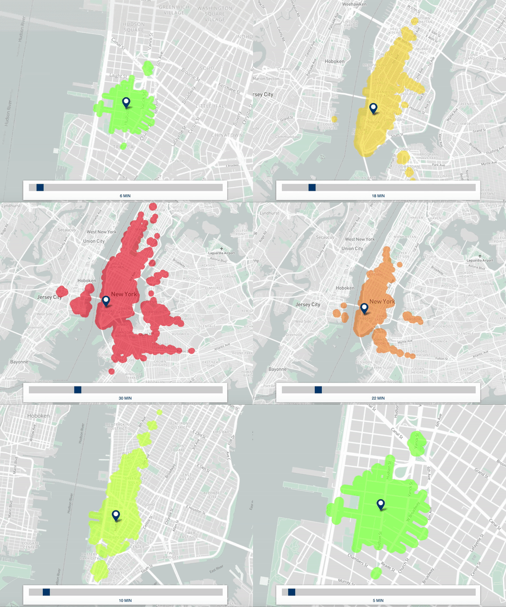
Travelsheds, also know as “isochrones”, map the set of destinations that can be reached from a specified location within a given time-budget. The resulting geometries give quick visual cues about location accessibility and can be further used in geospatial analysis to answer questions like:
Travelsheds, also know as “isochrones”, map the set of destinations that can be reached from a specified location within a given time-budget. The resulting geometries give quick visual cues about location accessibility and can be further used in geospatial analysis to answer questions like:
- How many people live within 10 minutes of a park?
- What is the number of businesses/jobs accessible from a new development?
For HR&A Advisors, I developed a web-based isochrone mapping application that leverages OpenTripPlanner to create a graph of city transportation infrastructure, merging local street networks and public transportation schedules.
I’ve layered on a simple point-and-click front-end that allows users to determine the average accessibility of any given point by various modes of transportation and time-distance and export the resulting shapefile for use in further geospatial analysis.
I’ve layered on a simple point-and-click front-end that allows users to determine the average accessibility of any given point by various modes of transportation and time-distance and export the resulting shapefile for use in further geospatial analysis.
February 2019
![]()
Time-distance travelsheds by public transit from Tribeca.

Time-distance travelsheds by public transit from Tribeca.